The Right Choice for Accuracy Analysis
A simple, fast, and complete workflow solution to verify the accuracy and quality of orthophotos — built for everyone in the imagery pipeline


A simple, fast, and complete workflow solution to verify the accuracy and quality of orthophotos — built for everyone in the imagery pipeline

CompassAA is CompassData’s dedicated accuracy and quality verification platform for orthophotography. Whether you’re producing imagery for airport environments, government contracts, or commercial applications, CompassAA gives you a proven, standards-compliant workflow to validate your products with confidence — without the complexity or cost of traditional verification methods. And because we know accuracy is non-negotiable, we let the platform speak for itself. Start a free 14-day trial today — full access, no credit card, no obligation.
Streamlined Accuracy & Quality Control
A guided, end-to-end workflow that eliminates manual steps and reduces verification time. CompassAA is designed to keep your production pipeline moving without sacrificing rigor.
Comprehensive Analysis Reports
Generate detailed, audit-ready reports that document every aspect of your accuracy assessment. Clear outputs your team, your clients, and compliance reviewers can all rely on.
Cost-Effective Verification
Purpose-built tooling means you’re not paying for features you don’t need. CompassAA delivers enterprise-grade accuracy analysis at a fraction of the cost of traditional alternatives.
Compliance with Industry Standards
CompassAA meets the requirements of NSSDA, ASPRS, NMAS, and MIL standards — so your imagery is verified to the benchmarks that matter most to planners, producers, and procurement teams.
Confirm imagery meets project accuracy requirements before committing to a dataset
Validate orthophotos against compliance standards before delivery
Receive independently verified, report-backed imagery you can trust
Work from data you know has been checked, documented, and cleared
Start verifying orthophotos against NSSDA, ASPRS, NMAS, and MIL standards from day one. Full platform access, no limits, no obligation. If CompassAA isn’t the right fit for your workflow, cancel anytime — no questions asked.
No. CompassAA works only with data that are in projected coordinate systems. It is important to know the projection information for your data and to collect and use data that are in the same projections as the standard projection(s) in use for your area.
A minimum of at least twenty checkpoints is recommended. However, for statistical rigor more than twenty points are suggested. For more information on survey points and designing a survey sample, refer to CompassAA's technical reference, Image Accuracy Checkpoint Collection Guide.
The use of specialized photogrammetry targets is not required. However, if they are available, it is strongly recommended that they be used for easier photo-identification of ground checkpoints.
A photogrammetric target is a standardized tool that is used in aerial photography to easily identify ground locations from an aerial photograph. For more information on the standard size specifications, refer to CompassAA's technical reference, Image Accuracy Checkpoint Collection Guide.
In performing an analysis in CompassAA it is required that when a location is turned off, the reasoning be justified and documented. This ensures there is a valid reason for turning off a location from being included in the analysis and it ensures that points are not randomly turned off. (Update: newer versions of CompassAA allow creation of customized reasons if defaults are not applicable.)
No. CompassAA only supports loading a .csv file. If the table you are trying to use is an Excel file, save it as a .csv file.
No. You can create a .csv file in Excel as well as WordPad or Notepad. If the file is created in WordPad or Notepad, be sure to separate the values with commas, be sure the columns are ordered by ID, Longitude, and Latitude, and finally be sure that there is no header. (Update: due to the need to use a projected coordinate system, longitude and latitude would be better described as easting and northing. Newer versions of CompassAA do not require the columns to be in a specific order.)
Yes. CompassAA requires that the columns be ordered ID, x-coordinate (longitude), and y-coordinate (latitude). If the table is not organized this way your analysis will be flawed. (Update: newer versions of CompassAA allow ad hoc selection of data columns of the imported .csv file. Please use projected easting and northing coordinates.)
In choosing a scale factor, you want to select a scale in which the surrounding context can still be determined in the image but at the same time the image is not overly pixelated.
If you are following all the steps set forth in the User Manual and using the program most efficiently, a project should take no longer than an hour. CompassAA is designed to produce quick yet reliable results.
To be certain you are using CompassAA as efficiently as possible, the first step is to read the pre-project checklist in section one of the User Manual. Make sure you are using local (non-network) files and that .rrd/.ovr files are in the same folder as the image data (if .rrd/.ovr files exist). Finally, be sure that the (checkpoint) images are in a folder where you can quickly browse through them using a photo viewer.
Yes! CompassAA allows the user to create detailed professional reports at the end of each project.
All reports created will be stored in the same file where the project you created has been saved.
Yes. CompassAA allows you to create as many reports as necessary. It is recommended that you create multiple reports with a different scale factor for each set of images to help gain a more thorough knowledge of the image data set.
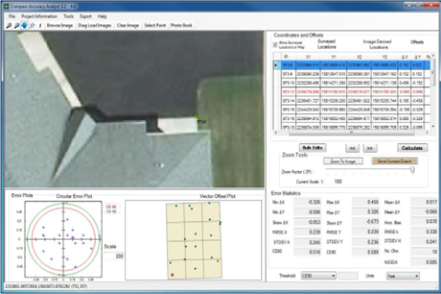
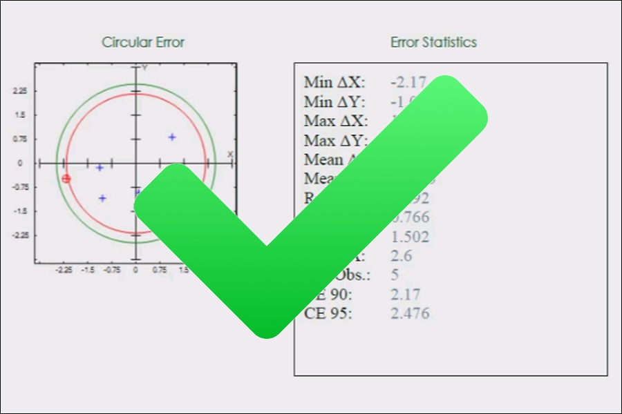
CompassAA is designed to inform the user how accurate a data set is based on National Map Accuracy Standards. CompassAA provides statistical reports for CE90, CE95, and RMSE.
It is recommended that a 3-digit numeric code be used, starting with point 000 and going to point 999. This system provides enough ID codes for checkpoint locations. If there are more than one thousand points per project, it is recommended to begin implementing an alpha-numeric code. Remember there can be no repeats for the ID number.
There is no limit on the number of images needed for a project, and using more images will not degrade the performance of CompassAA. CompassAA only pulls what it needs, when it needs it, which is why it can work so fast. It identifies the images by the polygon, not the image itself.
To see the vector offsets more clearly in the vector offset plot, you can increase the associated scale factor.
The values highlighted in red indicate those values that exceed the threshold set by the user.
Currently, CompassAA does not have an export option for the plots or the tables. This capability will be provided in a soon-to-be-released "New Features Update" to CompassAA. (Update: current versions of CompassAA support exporting the graphic and tabular features of the application window to .bmp files. A .csv and/or .shp file of the reviewed checkpoints can also be created and exported.)
When an update for CompassAA is released, CompassData will notify you via email and you will be sent a link that will allow you to download the updated version and instructions for installation so that you may continue using CompassAA.
Enter your details to chat.