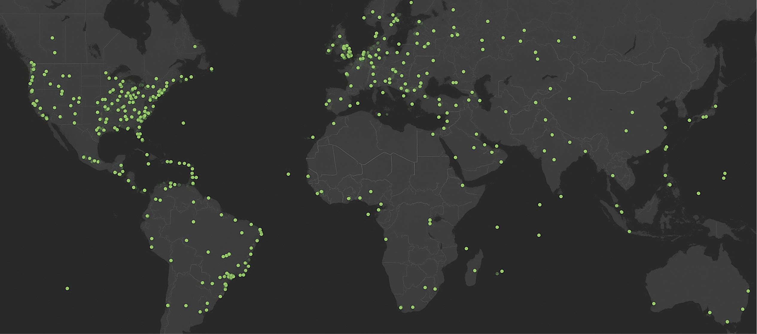
Trusted Around the globe
Ground Control Points
Delivering accuracy, reliability, and geospatial expertise anywhere in the world.

Delivering accuracy, reliability, and geospatial expertise anywhere in the world.

Access verified GCPs globally or deploy custom survey teams to meet your project requirements.
We collect Ground Control Points globally to meet your project requirements or provide access to verified GCPs from our archive. Backed by 30+ years of experience and ISO 9001:2015-certified workflows, CompassData delivers accurate, reliable data in standard formats.
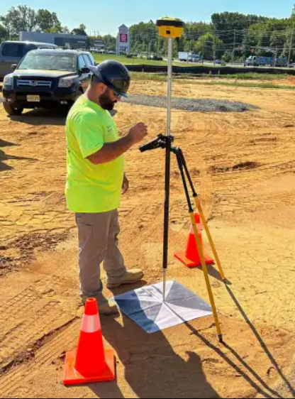
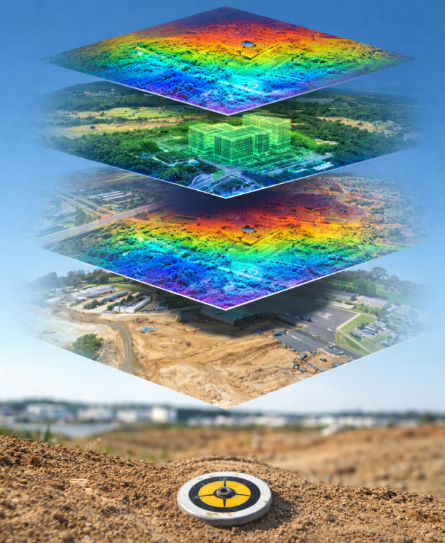
Ground Control Points ensure geospatial data is accurately aligned to real-world coordinates. By integrating verified control, you improve positional accuracy, validate results, and create reliable datasets for engineering, infrastructure, and advanced mapping applications, including AI-driven analysis and digital twin development.
Accurate ground truth improves model performance, supports automation, and increases confidence in every dataset.
Get the data you need in the formats you require.
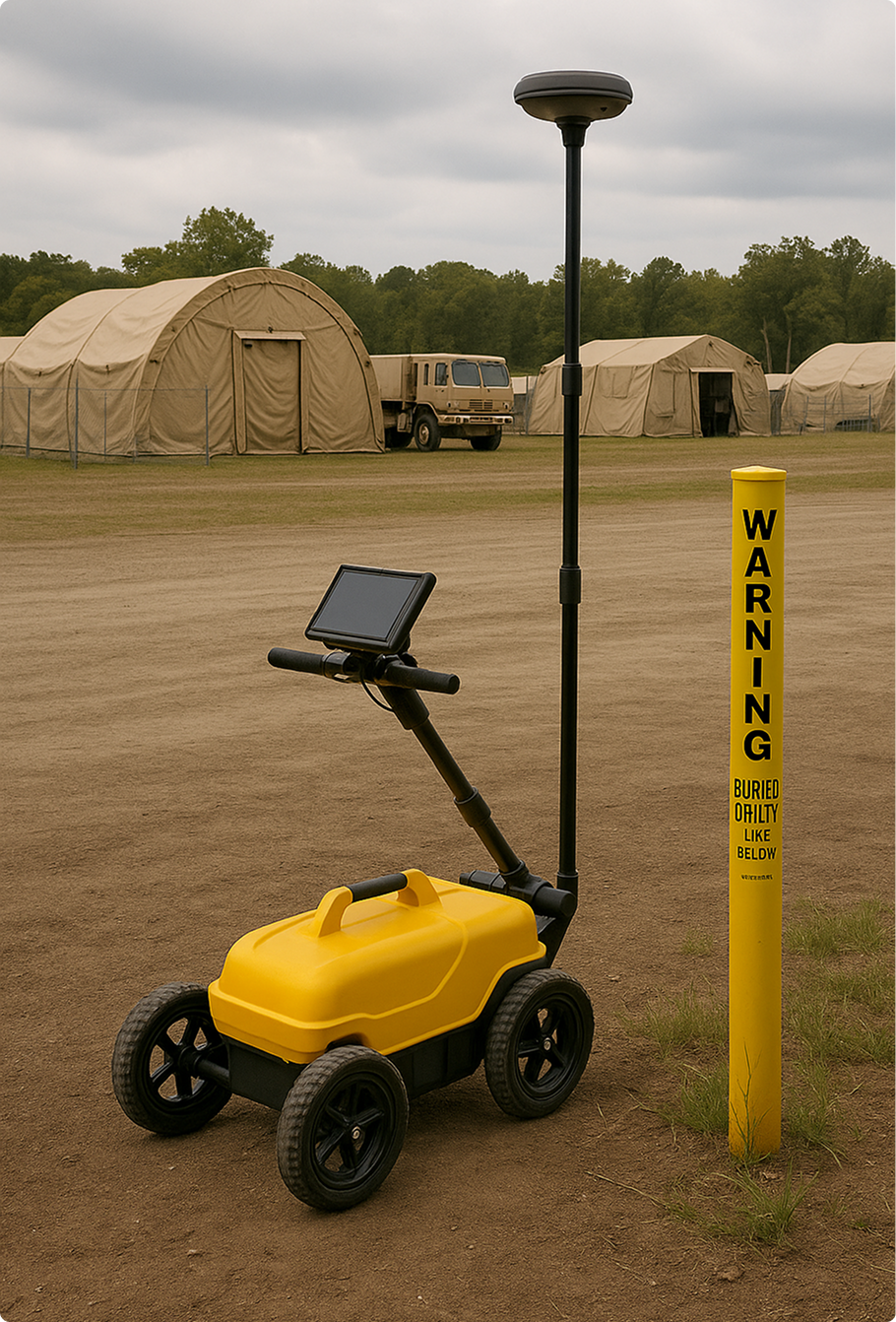
In 2022–2023, CompassData was contracted by the U.S. Army Corps of Engineers (USACE) St. Louis District to conduct a comprehensive Utility Asset Collection (UAC) project supporting the Army National Guard across sites in California, Texas, New Jersey, and Rhode Island. The mission: map and verify both above-ground and underground utilities, including electrical, gas, thermal water, sewage, fire protection, and POL systems.
The project followed a two-phase approach: data discovery and field verification. CompassData began by analyzing and transforming legacy CAD utility drawings into GIS-ready geodatabases compliant with SDSFIE 4.0 (Army National Guard Adaptation). Discrepancies were identified and rectified to ensure data accuracy before field deployment.
On-site, CompassData used advanced GPS, ground-penetrating radar (GPR), and tone locators to detect and document buried utilities. Even in areas with limited surface access, high-accuracy utility mapping was achieved. Verified utility features were cataloged in clean, structured geodatabases along with detailed “Found on Site” reports.
This firm-fixed-price contract was completed ahead of schedule, with CompassData’s deliverables exceeding quality benchmarks and earning praise from project officials. The geospatial data is now actively supporting infrastructure planning and asset management for the Army National Guard.
GCPs are used to georeference and correct spatial inaccuracies in geospatial data, ensuring that imagery and models align with real-world coordinates. Check points, on the other hand, serve as independent reference markers to validate the accuracy of processed data without being used for direct adjustments.
Ground Control Points (GCP) accuracy depends on the geodetic survey methods and equipment used. When surveyed with high-precision GNSS and differential GPS techniques, Ground Control Points (GCPs) can achieve sub-centimeter accuracy, making them ideal for high-resolution mapping and accurate geospatial applications.
While not always required, Ground Control Points (GCPs) significantly improve the accuracy of aerial surveys, especially when high precision is needed for infrastructure projects, environmental assessments, or topographic mapping. In cases where survey-grade accuracy is required, Ground Control Points (GCPs) play a critical role in reducing errors.
Ground Control Points (GCPs) provide real-world coordinates that align photogrammetric models with the true Earth's surface. By anchoring 3D models to known positions, Ground Control Points (GCPs) improve accuracy in applications like architectural modeling, terrain reconstruction, and virtual reality simulations for urban planning.
Yes, Remotely Sensed GCPs (RSGCP™) provide reliable control points for areas that are difficult to access due to rough terrain, safety hazards, or restricted zones. These remotely sensed control points enable geospatial accuracy in challenging environments, including dense forests, mountainous regions, and disaster-stricken areas.
Ground Control Points (GCPs) ensure high-accuracy georeferencing for satellite, aerial, and drone imagery, reducing distortions and aligning spatial data with real-world locations. They are crucial for mapping, surveying, construction, and GIS applications where precision and accuracy are essential.
Yes, Ground Control Points (GCPs) can be used in remote or hazardous areas. When physical placement is challenging, alternatives like Remotely Sensed GCPs (RSGCP™), aerial GCPs, or satellite-based control points provide accurate geospatial referencing without on-site access.
Ground Control Points (GCPs) are the foundation of Geospatial Accuracy. They are essential for unlocking the full potential of geospatial data. They serve as the anchor points that dramatically improve positional accuracy, enhance the quality of 3D modeling, and ensure the precision needed for critical infrastructure projects. GCPs also play a vital role in disaster response planning, land use management, environmental monitoring, and more. Across industries—from transportation and construction to agriculture and defense—reliable Ground Control Points are the difference between rough estimates and confident, actionable decisions. With CompassData’s expertly collected GCPs, your data isn’t just mapped—it’s trusted.