the Global leader
The World’s Largest, Most Accurate, Commercially Available GCPs Archive
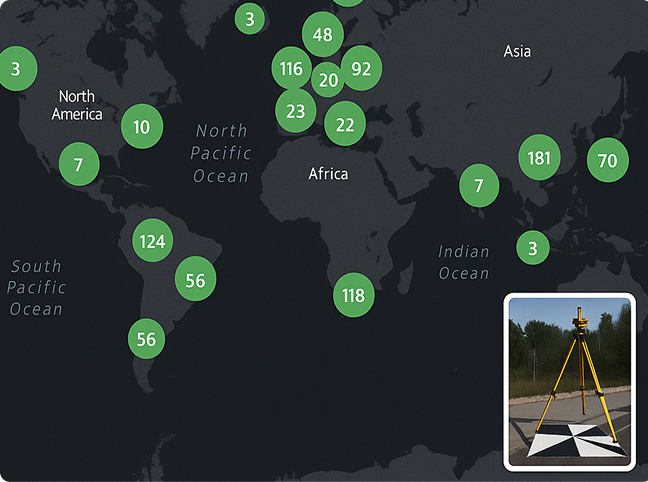
Over 85,000 GCPs available. All in a fully interactive, web-accessible map.


Over 85,000 GCPs available. All in a fully interactive, web-accessible map.

Explore the quality and accuracy of CompassData’s trusted GCP archive—trusted by top mapping professionals worldwide. Ensure that your project’s data is tied to a specific, human-verified location on earth. Zoom in and click on individual points to view associated photos, stations diagrams and accuracy reports.
Our extensive GCPs archive is built to support everything – whether you’re aligning a single drone survey or validating an entire satellite imagery library. CompassData’s GCPs help you save time, reduce field costs, and streamline accuracy validation.
Get immediate access to pre-surveyed, verified control points to correct geolocation errors, validate data accuracy, and integrate seamlessly into any mapping workflow — no resurveying, no delays.
Utilizing Ground Control Points with superior accuracy during the orthorectification process can achieve absolute positional accuracy matching or exceeding the pixel size of the imagery—enhancing mapping precision, reducing geolocation errors, and minimizing the need for time-consuming data corrections or reprocessing.
Our global Ground Control Point archive is displayed on an interactive map. Explore individual points, view photos, station diagrams, and detailed accuracy reports.
Request access to download the archive (truncated) in Esri Shapefile or Google Earth KML format for seamless integration into your GIS or mapping platform.
All Ground Control Points in the CompassData archive are validated through rigorous quality assurance protocols under our ISO 9001:2015-certified quality management system, ensuring reliable geospatial data for professional mapping applications.
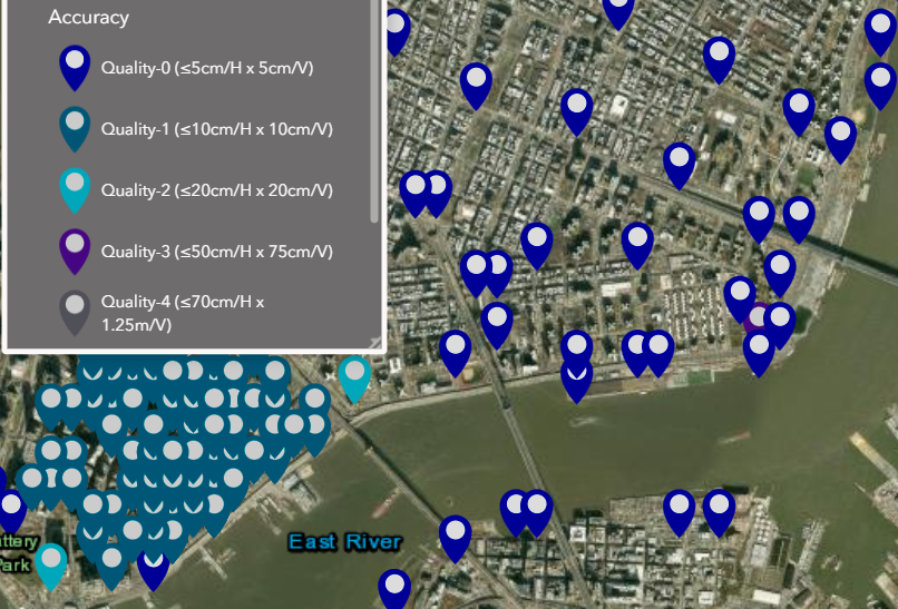
Each Ground Control Point from the CompassData archive is delivered in a ready-to-use data package designed to integrate seamlessly into your workflow.
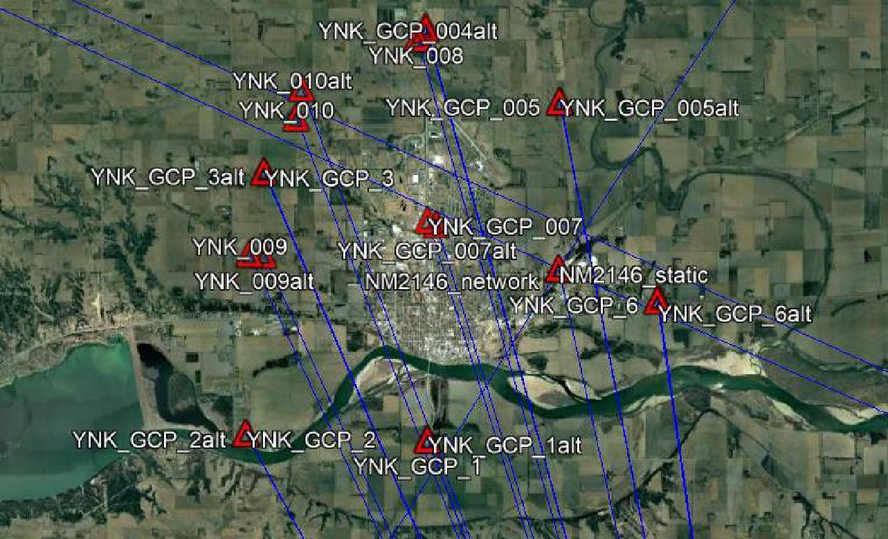
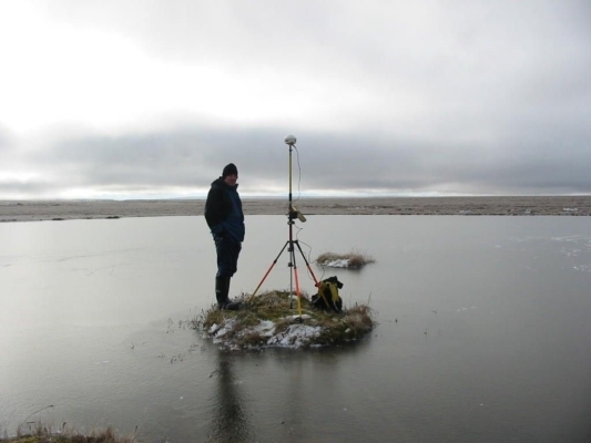
Archive ground control available to support production and QA/QC of imagery and LiDAR products.
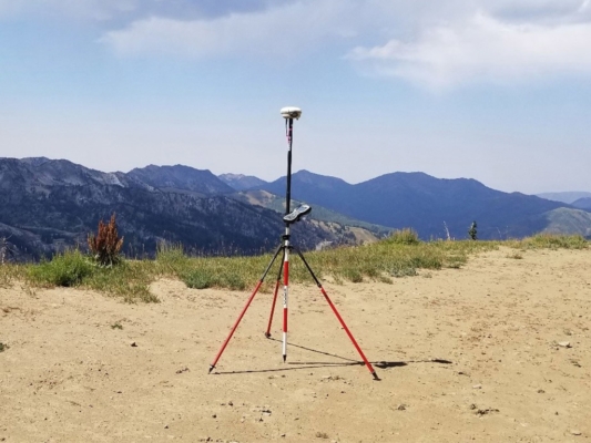
CompassData Archive GCPs can be used for NVA LiDAR control for LiDAR data production and QA/QC activities.
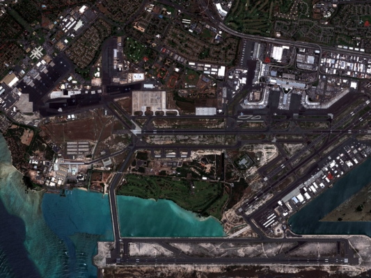
The archive includes clusters of GCPs that are strategically located over 1,100 airports across the globe. These GCPs are processed via FAA-DO 200A to support authoritative and commercial image production for aerodromes around the world.
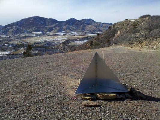
Derived from Synthetic Aperture Radar (SAR) sensor technology or imagery products to enable photo-ID control with RS-1 Precision ≤ 1m or RS-2 Precision ≤ 3m. RSGCPs are an option for photo control without sending a surveyor to the field in areas that are politically or logistically challenging.
Both formats provide ready-to-use data for mapping, planning, and analysis workflows. The archive is ideal for environmental studies, infrastructure development, urban planning, and location intelligence applications.
Ground Control Points (GCPs) are precisely surveyed locations on the Earth’s surface with known geographic coordinates, used to georeference satellite imagery, aerial photos, LiDAR, and drone data. In remote sensing and mapping, GCPs serve as reference points to correct positional inaccuracies and tie digital data to real-world coordinates—essential for creating accurate maps and geospatial products.
Ground Control Points are vital for ensuring geospatial accuracy in aerial and satellite imagery. They provide fixed reference locations that align image pixels to precise geographic coordinates. This process, called orthorectification, removes distortions caused by camera angles, elevation changes, and sensor geometry—enabling consistent, measurable, and reliable imagery for GIS, surveying, and spatial analysis applications.
GCPs significantly enhance mapping accuracy by serving as ground-truth references during image processing. When incorporated into photogrammetric workflows, GCPs correct distortions, improve spatial alignment, and reduce horizontal and vertical errors. This results in more accurate digital elevation models (DEMs), orthomosaics, and GIS datasets—especially important for high-resolution or engineering-grade projects.
While both Ground Control Points and Check Points are surveyed locations with known coordinates, they serve different purposes. GCPs are used during image processing to calibrate and align data. Check Points, on the other hand, are reserved for post-processing accuracy validation—helping verify the spatial integrity of georeferenced imagery without influencing the processing itself. Together, they ensure high confidence in final geospatial products.
GCPs are typically collected using high-precision GPS, GNSS receivers, or total stations operated by trained surveyors. Field collection follows strict geodetic and quality assurance protocols, often in accordance with ISO 9001:2015-certified standards. Each GCP includes documentation such as site sketches, field photos, and metadata, ensuring transparency, repeatability, and accuracy in geospatial workflows.
The achievable accuracy of GCPs depends on the survey method and quality classification. High-quality GCPs can achieve centimeter-level precision, typically ranging from 1–5 cm for Quality-0 control points. Lower quality levels may provide accuracies within sub-meter to multi-meter ranges. Choosing the appropriate accuracy level is critical for applications such as infrastructure development, flood modeling, and precision agriculture.
Absolutely. GCPs are essential for enhancing the geospatial accuracy of drone mapping projects. By anchoring aerial imagery to known ground coordinates, GCPs improve orthomosaic alignment, reduce geolocation drift, and boost overall positional accuracy—especially when GPS RTK/PPK is unavailable or insufficient. GCPs are a best practice for drone-based surveying, construction site monitoring, and asset inspection.
GCPs are commonly delivered in a variety of industry-standard file formats, including ESRI shapefiles (SHP), Google Earth KML/KMZ, and CSV or TXT spreadsheet formats. These files include coordinate data (Latitude, Longitude, Elevation, Easting, Northing), metadata, and projection information—making them easy to import into GIS, CAD, remote sensing, and photogrammetry software environments.
Yes, Ground Control Points are frequently used for LiDAR QA/QC and calibration, particularly in Non-Vegetated Vertical Accuracy (NVA) assessments. While LiDAR sensors can produce highly accurate elevation models, GCPs validate the vertical and horizontal accuracy of point clouds and digital terrain models. Using GCPs in LiDAR workflows enhances data confidence for applications such as flood modeling, terrain analysis, and infrastructure mapping.
Ground Control Points are a critical asset in multiple industries that require precise, georeferenced spatial data. These include land surveying, civil engineering, construction, urban planning, forestry, agriculture, defense, mining, and environmental monitoring. GCPs ensure that remote sensing and mapping outputs meet regulatory standards, engineering specifications, and operational accuracy needs across a wide range of geospatial applications.
Enter your details to chat.