Mobile mapping uses a vehicle-mounted platform equipped with LiDAR sensors, 360° cameras, and GNSS/IMU systems to collect high-density geospatial data along roads, railways, utility corridors, and urban environments.
Benefits of Mobile Mapping
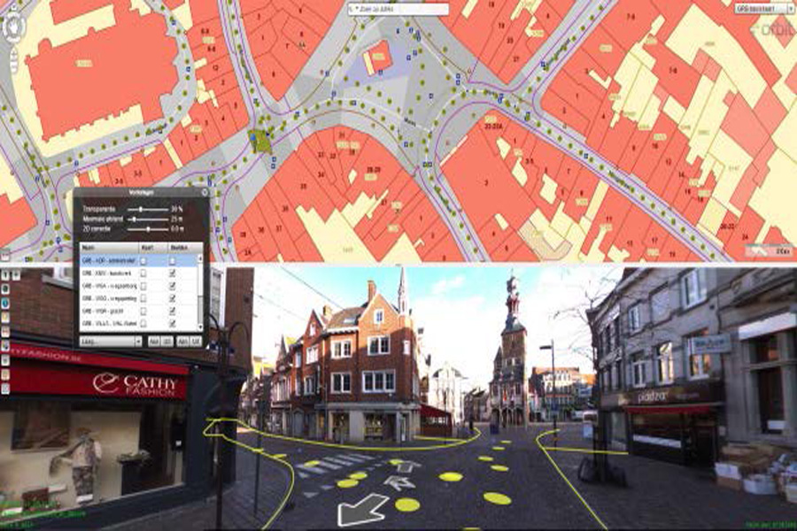
360° Panoramic Imagery for Immersive Visual Context
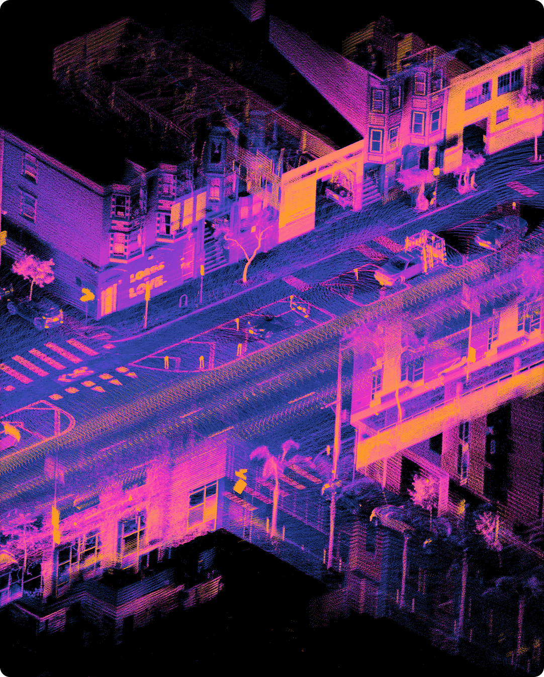
High-Speed, High-Density LiDAR for Detailed Surface Capture
Integrated GNSS & Inertial Navigation for Precise Positioning
Why Choose CompassData for Mobile Mapping
ISO 9001:2015 QA/QC Standards & FAA-Compliant Processes
Custom Deliverables Tailored to GIS, CAD, & Engineering Requirements
Rapid Deployment Across North America – No Matter How Remote
Experienced Field Teams who Understand Corridor Safety & Data Requirements
Integrated Solutions with our Ground Control & Aerial LiDAR & Imagery Offerings
Our Cutting-Edge Trimble MX60 System Delivers Superior Performance
What You get with Mobile Mapping
Digital Elevation Models (DEMs)
Classified Point Clouds (LAS/LAZ Formats)
Orthophotos & 360° Panoramic Imagery
Geospatial Metadata & Accuracy Reports
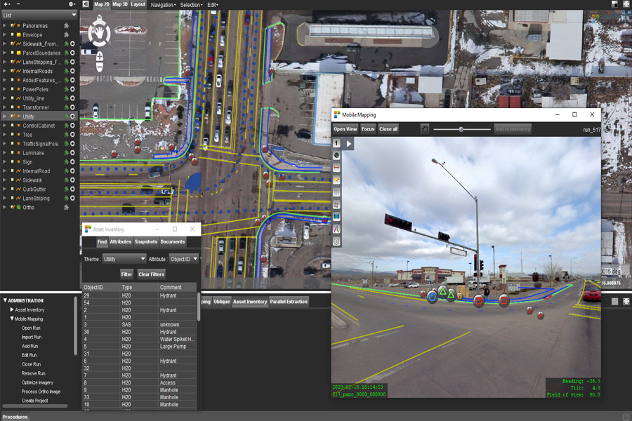
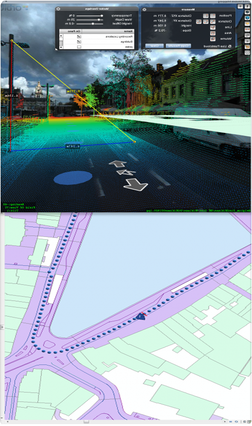
Vector Features Such as Road Edges, Utilities, & Signage
Asset Inventory Databases for Infrastructure & Field Features
Operational Versatility for Challenging Environments
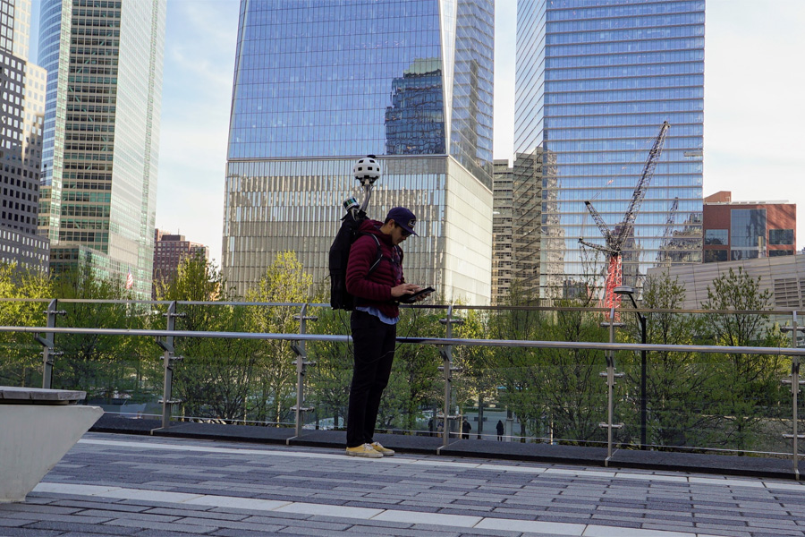
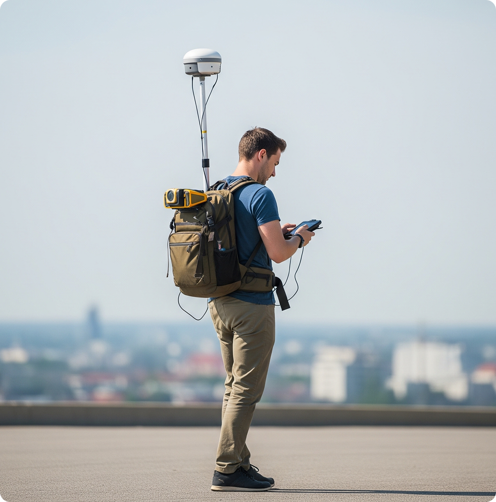
Engineered for environments inaccessible to vehicles, backpack mobile mapping enables data collection in tight, rugged, or hazardous spaces.
Street-Level Mapping
Capture Once, Analyze Anywhere
Ideal for documenting transportation corridors, utility lines, and critical infrastructure conditions.
Eliminates the need for repeat field visits by capturing rich, high quality data the first time improving quality control and decision-making.
Success Story
Winter Park Aerial Survey & Geospatial Mapping Solution
High-Accuracy LiDAR, Imagery & Mobile Mapping Across 35 Square Miles
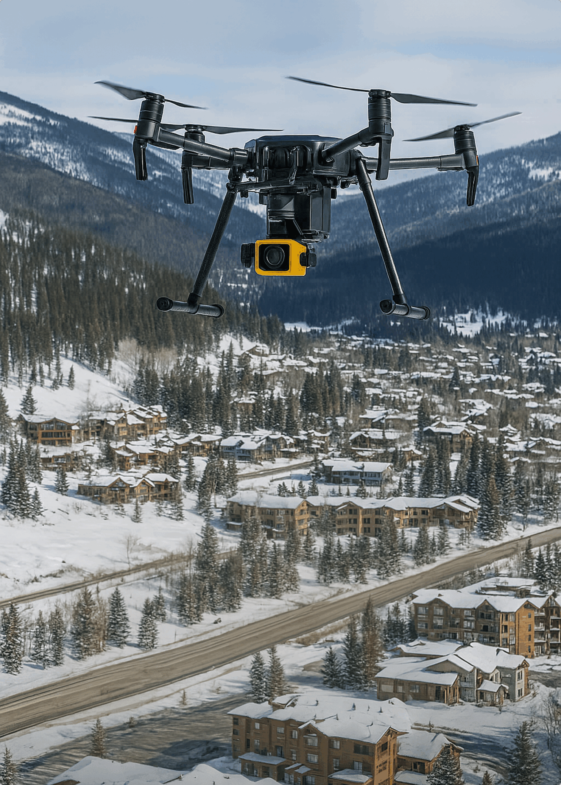
In Fall 2019, CompassData completed a high-precision aerial and mobile mapping project across 35 square miles of Winter Park, Colorado, covering rugged terrain ranging from 8,500 to 12,500 feet. Under urgent conditions, CompassData deployed within 24 hours, installing aerial targets and capturing both LiDAR and oblique/nadir imagery with the Leica CityMapper sensor.
Using drone and mobile mapping, terrestrial surveys, and a network of local base stations, CompassData delivered a rich geospatial dataset including LiDAR point clouds, orthoimagery, planimetry, 2-ft contours, and 360° street-level views. Despite challenging logistics, the project was delivered within 90 days—on time, under budget, and exceeding accuracy standards.
Winter Park’s Planning Director praised the results: “They exceeded what they said they would do.” Final deliverables surpassed ASPRS accuracy recommendations, supported by FAA-qualified software (CompassAA & CompassTA), ensuring Winter Park Resort has reliable 3D geospatial data for planning, infrastructure, and development.
Mobile mapping uses a vehicle-mounted platform equipped with LiDAR sensors, 360° cameras, and GNSS/IMU systems to collect high-density geospatial data while in motion along roads, railways, utility corridors, and urban environments.
What system does CompassData use for mobile mapping?
CompassData uses the Trimble MX60 system, which captures high-resolution LiDAR and panoramic imagery for survey-grade results.
What deliverables come from a mobile mapping project?
Depending on your project, deliverables can include Digital Elevation Models, classified point clouds (LAS/LAZ), orthophotos and 360° panoramic imagery, vector features like road edges and utilities, and full asset inventory databases.
Is mobile mapping available for areas vehicles can't reach?
Yes. CompassData offers backpack mobile mapping for tight, rugged, or hazardous environments that are inaccessible to vehicle-mounted systems.
What industries use CompassData's mobile mapping services?
Mobile mapping supports utility and pipeline corridor mapping, transportation infrastructure, vegetation and right-of-way (ROW) analysis, smart city and asset inventory programs, oil and gas infrastructure, disaster response, and digital twin/3D urban modeling.