

Explore success powered by CompassData


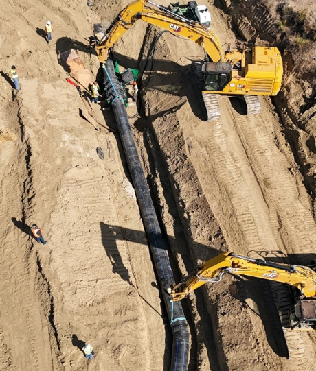
CompassData, Inc. completed one of the largest land surveys in Colorado history, spanning over 120 miles from Pueblo to Lamar across five counties. This critical project supported the Fryingpan-Arkansas (Fry-Ark) Water Reclamation Project, a massive infrastructure effort delivering clean water from the western slopes of the Continental Divide to the Arkansas River Valley.
As part of this strategic initiative, CompassData provided high-precision boundary mapping for water transmission pipelines, identifying easements and legal limits vital for construction and maintenance. The survey also revealed key environmental insights, including elevated cancer risks in counties lacking Reverse Osmosis (RO) treatment—highlighting the urgent need for clean water access.
Using advanced drone mapping, LiDAR scanning, and PLSS corner upgrades, CompassData addressed the complexity of surveying through 16 diversion structures and 9 tunnels across rugged terrain. The result: reliable, GIS-ready data that empowers sustainable water planning and supports communities facing groundwater contamination.
This project reinforces CompassData’s leadership in large-scale geospatial surveys, right-of-way (ROW) mapping, and environmental infrastructure solutions across Colorado and the western U.S
CompassData, Inc. successfully completed a 290-mile gas pipeline survey across the challenging terrain of Lake of the Ozarks, one of the most rugged shorelines in the U.S. The project included detailed mapping of mainline and service lines, over 2,500 gas meters, and 60 miles of service line, navigating both rural and urban environments.
Using the MoDOT VRS network, advanced laser rangefinders, and daily post-processing workflows, CompassData ensured high-accuracy, sub-foot data collection. Survey teams documented pipeline issues—such as shallow cover, missing meters, and incomplete installations—with georeferenced photos and metadata to support asset management and compliance.
All deliverables were integrated into Summit Utilities’ GIS database, enhancing their ability to locate meters, plan repairs, and manage assets efficiently. The geospatial data was fully compatible with ESRI® GIS systems and other mapping platforms, ensuring company-wide access and long-term operational value.
CompassData’s expertise in buried utility mapping, pipeline surveys, and GIS data integration proved essential for delivering accurate, verifiable geospatial data on time and within budget.
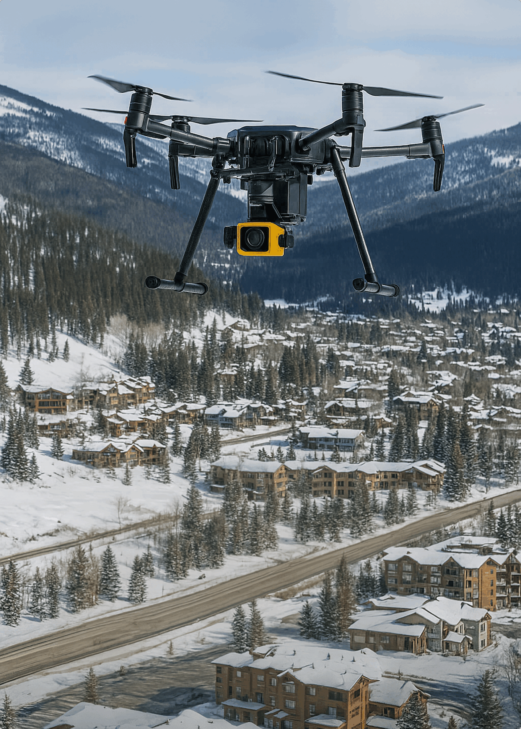
In Fall 2019, CompassData completed a high-precision aerial and mobile mapping project across 35 square miles of Winter Park, Colorado, covering rugged terrain ranging from 8,500 to 12,500 feet. Under urgent conditions, CompassData deployed within 24 hours, installing aerial targets and capturing both LiDAR and oblique/nadir imagery with the Leica CityMapper sensor.
Using drone and mobile mapping, terrestrial surveys, and a network of local base stations, CompassData delivered a rich geospatial dataset including LiDAR point clouds, orthoimagery, planimetrics, 2-ft contours, and 360° street-level views. Despite challenging logistics, the project was delivered within 90 days—on time, under budget, and exceeding accuracy standards.
Winter Park’s Planning Director praised the results: “They exceeded what they said they would do.” Final deliverables surpassed ASPRS accuracy recommendations, supported by FAA-qualified software (CompassAA & CompassTA), ensuring Winter Park Resort has reliable 3D geospatial data for planning, infrastructure, and development.
CompassData, in partnership with KCSI Aerial Patrol, has been delivering quarterly aerial mapping and thermal imagery for Sentinel Peak Resources across major oil fields in California’s San Joaquin Valley and Los Angeles Basin since 2019. Covering over 24 square miles, this long-term project combines LiDAR, RGB, thermal, DSM/DTM, and change detection data to support asset management and field operations.
Using state-of-the-art equipment such as the RIEGL VUX240, WaldoAir XCAMB RBG + NIR, and radiometric thermal sensors, CompassData ensures high-resolution orthomosaics and accuracy reports for each collection. Aerial GNSS control with Trimble RTK systems complements manned aircraft operations for maximum geospatial precision.
Each project cycle includes detailed reports, change detection analytics, and thermal performance insights reviewed by Sentinel Peak’s operations and engineering teams. All data is delivered to strict industry specifications and reviewed collaboratively to ensure quality and compliance.
This ongoing collaboration demonstrates CompassData’s ability to support oil and gas infrastructure mapping, offering reliable, safe, and IOGP-compliant aerial services with consistent, on-time, and cost-effective results.
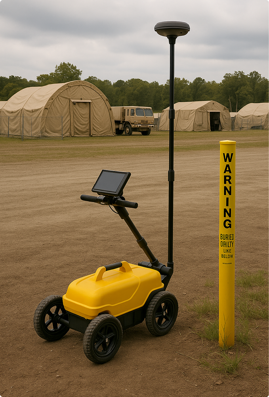
In 2022–2023, CompassData was contracted by the U.S. Army Corps of Engineers (USACE) St. Louis District to conduct a comprehensive Utility Asset Collection (UAC) project supporting the Army National Guard across sites in California, Texas, New Jersey, and Rhode Island. The mission: map and verify both above-ground and underground utilities, including electrical, gas, thermal water, sewage, fire protection, and POL systems.
The project followed a two-phase approach: data discovery and field verification. CompassData began by analyzing and transforming legacy CAD utility drawings into GIS-ready geodatabases compliant with SDSFIE 4.0 (Army National Guard Adaptation). Discrepancies were identified and rectified to ensure data accuracy before field deployment.
On-site, CompassData used advanced GPS, ground-penetrating radar (GPR), and tone locators to detect and document buried utilities. Even in areas with limited surface access, high-accuracy utility mapping was achieved. Verified utility features were cataloged in clean, structured geodatabases along with detailed “Found on Site” reports.
This firm-fixed-price contract was completed ahead of schedule, with CompassData’s deliverables exceeding quality benchmarks and earning praise from project officials. The geospatial data is now actively supporting infrastructure planning and asset management for the Army National Guard.