The Archive Built for Accuracy-Critical Environments
30–50cm satellite ortho imagery, orthorectified to less than 0.85cm accuracy and verified through our FAA certification process.


30–50cm satellite ortho imagery, orthorectified to less than 0.85cm accuracy and verified through our FAA certification process.

When accuracy is non-negotiable, CompassData delivers. Our satellite ortho imagery archive provides 30–50cm pixel resolution with orthorectified accuracy below 0.85cm — meeting the rigorous standards required for authoritative and non-authoritative airport applications. Every product is verified through CompassAA, our FAA-certified accuracy qualification tooling, so you can trust what you’re working with.

Certified orthoimagery ready utilization into safety critical environments
Our airport archive database enables custom feature digitization with attribution for the aviation market
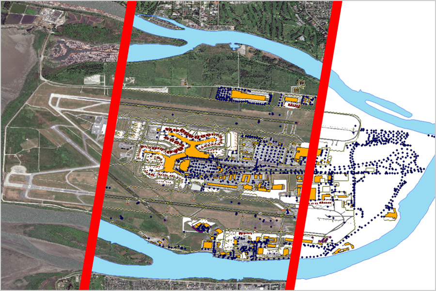
The Global Airport Imagery Archive is a comprehensive database of high-resolution, orthorectified satellite imagery covering over 700 airports worldwide, designed for aviation mapping, avionics integration, and simulation.
The airport orthoimagery in the archive offers pixel resolutions between 30 cm and 50 cm, providing detailed, high-accuracy visuals for flight planning, navigation systems, and airport infrastructure analysis.
Our satellite imagery achieves horizontal positional accuracy better than 0.85 meters, meeting strict FAA and aviation standards for reliable geospatial data in critical environments.
Yes, the airport imagery is processed in compliance with FAA DO-200A certification standards, ensuring the imagery is validated and suitable for use in safety-critical aviation applications.
Airport satellite imagery benefits airport operators, avionics system developers, aviation authorities, EFB providers, the Department of Defense, military agencies, and flight simulation companies needing precise geospatial data.
CompassAA is a proprietary accuracy assessment tool used to verify positional data integrity. It supports least-squares minimization techniques to confirm image alignment and orthorectification against FAA accuracy standards.
Yes, we provide custom feature digitization from our archive, including runways, taxiways, terminals, and other airport features, with full attribution for aviation software and systems.
Off-the-shelf satellite imagery from the archive is available for rapid delivery, enabling quick integration into your aeronautical mapping or simulation project.
Off-the-shelf satellite imagery from the archive is available for rapid delivery, enabling quick integration into your aeronautical mapping or simulation project. Airport imagery is available in multiple geospatial formats including GeoTIFF, JPEG2000, and custom formats to ensure compatibility with aviation GIS and flight planning systems.
You can request a quote for airport orthoimagery data by visiting our Global Airport Imagery Archive page and filling out the inquiry form with your area of interest and project specifications.