
ASPRS Positional Accuracy Standards for Digital Geospatial Data, Edition 2, Version 2 (2024), provide a modern framework for measuring and reporting the horizontal and vertical accuracy of digital geospatial products. For aerial LiDAR and orthoimagery projects, compliance depends on more than a general claim of accuracy. Firms must validate results against independently surveyed, higher-accuracy checkpoints and report the results using the required root mean square error, or RMSE, methodology.
That independent ground truth is essential before final deliverable acceptance. CompassData provides professionally surveyed Ground Control Points, or GCPs, and documented accuracy information that help aerial survey firms, LiDAR processing teams, and geospatial professionals evaluate RMSE compliance with confidence.
What Are the ASPRS Positional Accuracy Standards?
The ASPRS Positional Accuracy Standards define a benchmark for measuring and reporting the horizontal and vertical accuracy of digital geospatial data. They are designed for modern digital workflows and replace older standards, including the ASPRS 1990 standard and the National Map Accuracy Standards, or NMAS, of 1947.
The current official version is Edition 2, Version 2 (2024). It was issued in June 2024 and updated earlier Edition 2 content to better reflect current geospatial technologies, processing methods, and reporting practices.
| Standard Version | Key Feature | Status |
|---|---|---|
| ASPRS 1990 | Designed primarily for paper-map accuracy reporting | Superseded |
| NMAS 1947 | National Map Accuracy Standards for traditional mapping products | Superseded |
| ASPRS Edition 2, Version 2 (2024) | Modular, digital-first standard for modern geospatial products | Current official version |
How Are the Standards Developed?
The standards are developed through industry consensus rather than by a single organization. ASPRS designed them to be modular, allowing specific sections and addenda to be updated as geospatial technologies evolve.
This structure makes it possible to add or revise guidance for emerging and advancing workflows, including aerial LiDAR, photogrammetry, UAS mapping, and field surveying, without rewriting the entire standard. ASPRS also publishes supporting addenda that provide best practices and guidelines for these applications.
Why Do These Standards Matter for Ground Control?
For firms collecting or using ground control points, the standards provide a consistent framework for evaluating positional accuracy, supporting NSSDA-based reporting, and documenting whether deliverables meet project requirements.
Without a defensible accuracy workflow, a survey or mapping firm risks delivering data that does not meet contract specifications, client expectations, or regulatory requirements. Reliable GCPs provide the independent, higher-accuracy reference needed to test aerial data rather than simply assume that a sensor, platform, or processing workflow performed as expected.
CompassData follows a rigorous, field-proven process to collect and validate Ground Control Points to high standards of accuracy and reliability. Learn more about CompassData’s survey and mapping data solutions for projects that require authoritative ground truth.
How Does NSSDA Compliance Affect LiDAR Projects?
NSSDA compliance provides a statistical framework for reporting the positional accuracy of geospatial data. For LiDAR projects, it shapes how deliverables are tested, documented, reviewed, and accepted by clients that require defensible accuracy statements tied to recognized standards.
The ASPRS positional accuracy standards build on NSSDA principles and provide modern guidance for evaluating digital geospatial products. They help project teams apply consistent measurement and reporting practices across technologies, including LiDAR and aerial mapping workflows.
What Does LiDAR Accuracy Reporting Require?
LiDAR projects should report positional accuracy using independent check points that are more accurate than the final product being evaluated. The current ASPRS standard recognizes RMSE as the accuracy measure for horizontal and vertical reporting.
Accuracy reporting should distinguish between horizontal and vertical components. For bare-earth LiDAR surfaces, non-vegetated vertical accuracy, or NVA, is a critical measure because it evaluates elevation accuracy in areas where the ground is clearly visible.
Projects that do not meet their specified accuracy class may require reprocessing, additional quality control, or, in some cases, a new acquisition. Identifying accuracy issues before final delivery can prevent costly schedule delays, rework, and client rejection.
How Do Ground Control Points Support NSSDA Compliance?
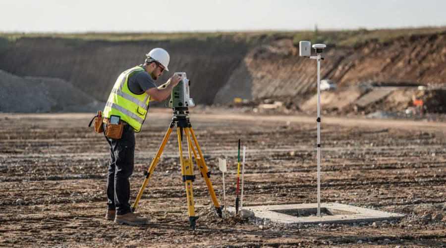
Professionally surveyed ground control points help anchor LiDAR accuracy assessments to known, real-world positions. CompassData survey teams use high-precision GNSS equipment, including dual-frequency GPS and GNSS receivers and total stations, to collect GCPs that support reliable accuracy testing.
Each point can be cross-checked against established control networks, including Continuously Operating Reference Stations, or CORS, and national geodetic databases. This helps ensure that the check points used for validation are accurate to a higher order than the LiDAR product being tested.
Without verified, independent checkpoints, LiDAR accuracy cannot be demonstrated through a defensible statistical process. Instead, project acceptance may depend on assumptions about the acquisition and processing workflow rather than measured evidence.
What Is Non-Vegetated Vertical Accuracy?
Non-vegetated vertical accuracy, or NVA, measures how closely LiDAR-derived elevations match surveyed ground elevations in open, unobstructed terrain. Typical NVA test areas include bare soil, pavement, short grass, sidewalks, and other locations where the laser can reach the ground without interference from trees, buildings, dense brush, or other vertical features.
NVA is a central measure for evaluating LiDAR point cloud quality and bare-earth elevation surfaces. It quantifies vertical error where ground conditions make it possible to assess sensor performance and processing quality with fewer complications from land cover.
How Does NVA Differ From Vegetated Vertical Accuracy?
ASPRS standards distinguish between non-vegetated vertical accuracy and vegetated vertical accuracy, or VVA. NVA evaluates open terrain, while VVA evaluates areas where vegetation and ground cover can affect LiDAR returns and ground-surface modeling.
NVA generally has tighter performance expectations because LiDAR pulses can reflect directly from the ground surface. Vegetated areas introduce additional uncertainty due to canopy penetration, understory conditions, terrain complexity, and the challenge of identifying the true ground elevation beneath vegetation.
| Accuracy Component | NVA: Open Terrain | VVA: Vegetated Terrain |
|---|---|---|
| Primary test environment | Open, unobstructed ground | Areas with trees, brush, or ground cover |
| Typical error source | Sensor calibration, GNSS positioning, surface modeling | Canopy penetration, ground cover, terrain, and surface modeling |
| Accuracy reporting | Reported as RMSEv against NVA check points | Reported as RMSEv and assessed as found |
| Role in project acceptance | Used to evaluate the specified vertical accuracy class | Reported separately, with acceptance terms defined by the project agreement |
Under the 2024 update, VVA does not carry a universal pass-or-fail threshold. It should be assessed and reported as found unless the data user and producer establish a separate requirement in advance.
Why Does NVA Matter for LiDAR Accuracy Specifications?
NVA is a primary benchmark for evaluating LiDAR sensor and processing performance. For example, a project specified to meet a 10 cm NVA vertical accuracy class must demonstrate an NVA RMSEv of 10 cm or less using appropriate independent check points.
The ASPRS vertical accuracy classes include 1 cm, 2.5 cm, 5 cm, 10 cm, 15 cm, 20 cm, 33.3 cm, 66.7 cm, 100 cm, and 333.3 cm NVA RMSEv classes. The required class should always be defined by the project specifications, intended application, terrain, and end-user tolerance.
CompassData supports this validation through documented ground control and accuracy reporting that quantify horizontal and vertical error. This gives project teams a clearer basis for confirming whether a LiDAR dataset satisfies the stated requirements for final acceptance.
Which LiDAR Accuracy Specifications Matter for Orthoimagery?
For orthoimagery, both horizontal and vertical accuracy matter. Horizontal accuracy affects where features appear on the map, while vertical accuracy affects the quality of the elevation model used during orthorectification.
A reliable LiDAR-derived elevation surface helps ensure that image pixels are correctly projected onto the ground. When vertical error is too large, features can shift, seams can become visible, and buildings, road edges, bridges, and terrain features may appear warped or misaligned in the final orthomosaic.
How Does NVA Affect Orthoimagery Quality?
NVA measures the accuracy of LiDAR elevations over bare-earth surfaces, including sidewalks, rooftops, pavement, and bare soil. This measurement is especially important for orthorectification because elevation errors can become visible as horizontal displacement in imagery, particularly on sloped terrain, tall structures, or scenes captured from oblique viewing angles.
A project that achieves its required NVA target is better positioned to produce orthomosaic tiles that align consistently. The appropriate vertical threshold depends on factors such as ground sample distance, sensor geometry, terrain, flight altitude, and client specifications.
Rather than treating one value as universal, project teams should match the required LiDAR accuracy class to the intended orthoimagery use. Engineering design, transportation planning, asset inventory, and visual reference mapping may each require different levels of positional confidence.
What Role Does CompassData Play in Meeting LiDAR Accuracy Requirements?
CompassData provides precision LiDAR acquisition and processing support anchored to authoritative ground control. Each project can draw on an archive of professionally surveyed GCPs, helping firms access validated control where it is available and obtain field-collected control where a site-specific collection is required.
Every GCP delivery can include documentation such as coordinates in multiple formats, metadata, site sketches, field photos, and detailed accuracy reports. This transparency supports quality assurance reviewers who need to understand how control was established and whether it is suitable for the project’s accuracy requirements.
| Accuracy Component | Example Project Target | Impact on Orthoimagery |
|---|---|---|
| Non-vegetated vertical accuracy | 10 cm NVA RMSEv or better, when specified | Supports a more reliable elevation surface for orthorectification |
| Horizontal accuracy | Project-specific RMSE requirement | Supports accurate placement of mapped features |
| Vegetated vertical accuracy | Reported as found, unless project terms define a threshold | Documents performance in wooded or vegetated areas |
Meeting the required specifications early can reduce manual seam editing, data rework, and the risk of re-flight. Verified ground truth gives aerial mapping teams a stronger foundation from the beginning of the workflow.
How Do You Verify Compliance With ASPRS Standards?
Verifying compliance requires comparing project deliverables against the positional accuracy thresholds and reporting requirements defined in the applicable ASPRS standard and the project specification. Aerial survey firms and LiDAR processing specialists use independently surveyed, higher-accuracy check points to assess whether their final data conforms to the requested accuracy class.
The 2024 ASPRS update increased the minimum number of check points required for product accuracy assessment from 20 to 30. For large projects, the standard limits the maximum number of check points to 120.
What Does the Verification Process Involve?
The process begins with independent check points collected to a higher accuracy standard than the data being evaluated. CompassData survey teams use high-precision GNSS equipment and field methods that may include static, rapid-static, or real-time kinematic, or RTK, surveys.
Each point can then undergo cross-checking against known control networks and post-processing with precise ephemeris corrections. These steps help quantify horizontal error and non-vegetated vertical accuracy with documented certainty.
| Verification Step | Purpose |
|---|---|
| Independent checkpoint collection | Provides higher-accuracy ground truth for testing the final product |
| GNSS post-processing with precise ephemeris corrections | Refines positioning and helps reduce systematic error |
| Cross-checking against CORS or national geodetic databases | Validates measurements against established reference networks |
| Accuracy calculation and RMSE reporting | Quantifies horizontal and vertical performance against the project requirement |
| Quality control review | Confirms that deliverables and documentation meet project specifications before delivery |
How Do Addenda and Quality Control Support Compliance?
The ASPRS standard includes addenda covering best practices and guidelines for photogrammetry, LiDAR, UAS, and field surveying. These materials help teams choose suitable methods, establish appropriate check points, and use consistent reporting formats.
CompassData reinforces these practices with quality control reviews that examine each checkpoint and data deliverable against the applicable project specifications. This approach helps government agencies and organizations in infrastructure, defense, and natural resource management document LiDAR accuracy performance and reduce the risk of rework or rejection.
Build Confidence With Verified Ground Control
Meeting ASPRS positional accuracy standards for aerial LiDAR and orthoimagery requires more than good intentions. It requires independently verified ground control, appropriate checkpoints, standards-based RMSE reporting, and documented quality control throughout the project lifecycle.
CompassData’s ISO 9001:2015-certified quality management system supports its archive of validated Ground Control Points and its broader geospatial services. The archive includes GCPs assessed through rigorous quality assurance protocols and classified by documented horizontal and vertical accuracy ranges.
Whether your team is planning a new LiDAR acquisition, validating an orthomosaic, or confirming the accuracy of a completed geospatial deliverable, contact our team today to discuss your project’s ground control and accuracy requirements.