
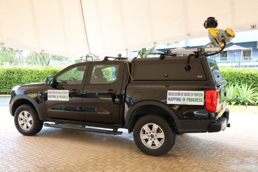
When a hurricane, flood, or wildfire hits, the agencies coordinating the response are only as fast and as accurate as the data underneath them. That’s the thinking behind a major new mobile mapping initiative just announced in Puerto Rico — and it’s a clear signal of where disaster-resilience planning is headed across the country.
In April 2025, Puerto Rico’s Department of Housing announced a $7.2 million mobile cartography initiative funded through CDBG-DR (Disaster Recovery) and CDBG-MIT (Mitigation) block grants. The program will send LiDAR-equipped vehicles down 21,400 linear miles of road across all 78 municipalities — including Vieques and Culebra — to capture a detailed, GIS-ready inventory of housing and critical infrastructure: power lines, water systems, telecommunications, and more (WIPR).
The goal isn’t just a prettier map. It’s a foundation for faster permitting, more accurate post-disaster cost estimates, better-optimized evacuation routes, and early-warning systems that are only as good as the infrastructure data feeding them.
Puerto Rico’s project is a large-scale example of a pattern playing out in state and local governments nationwide: agencies are realizing that resilience planning depends on accurate, current, GIS-ready geospatial data — not decades-old survey records or fragmented municipal datasets.
Mobile mapping platforms combine several technologies to make this possible:
Together, these tools let agencies build the kind of standardized geospatial database Puerto Rico is targeting — one that supports everything from permitting workflows to emergency response, without requiring a separate survey crew for every use case.
Here’s what often gets left out of the mobile mapping conversation: LiDAR and 360-degree imagery are only as trustworthy as the ground control points (GCPs) used to verify them.
Mobile mapping systems generate enormous volumes of data quickly, but without certified, photo-identifiable ground control, that data can drift out of tolerance — which is a serious problem when the end use is emergency response, floodplain modeling, or infrastructure vulnerability assessments. A resilience-mapping program is only as reliable as its weakest control point.
This is why large-scale geospatial infrastructure programs — like Puerto Rico’s GeoFrame initiative — pair mobile data collection with rigorous ground-truthing: certified GCPs, accuracy verification, and standardized formats that hold up across every municipality and every dataset layer.
Puerto Rico’s initiative offers a useful blueprint for any state agency, municipality, or infrastructure organization evaluating its own disaster-resilience mapping strategy:
CompassData works with agencies and organizations building exactly this kind of geospatial infrastructure. Our services include:
Whether you’re planning a statewide resilience-mapping program or need to verify the accuracy of an existing mobile mapping dataset, CompassData’s ground truth data helps make sure your geospatial infrastructure holds up when it matters most.
Ready to talk through your project? Contact CompassData to discuss ground control points, mobile mapping, or aerial imagery for your next disaster-resilience initiative.