
Utility departments face a hard tradeoff every time they need to survey underground infrastructure in a busy intersection: send crews into live traffic to get accurate data, or accept gaps in the GIS record. Aurora Water’s Transmission and Distribution GIS Updates Project shows there’s a third option — and it’s one CompassData helped deliver alongside Merrick & Company.
Traditional subsurface utility surveys in high-traffic intersections are expensive and slow. They typically require multiple field crews, coordinated traffic control, and city permitting just to safely locate valves, manholes, waterlines, and junctions. The risk isn’t hypothetical, either — in the summer of 2018, three Aurora Water employees were severely injured in an automobile accident while working inside a busy intersection, despite having standard safety measures in place.
Aurora Water needed a way to map the location of its assets that was both cost-effective and safer for field personnel. That’s where mobile mapping came in.
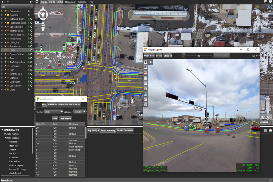
Merrick & Company worked with CompassData to implement a mobile mapping solution using Trimble’s MX7 platform, aimed at improving both efficiency and field safety compared to conventional survey methods.
Here’s how the workflow came together:
At a collection rate of roughly 10 intersections per day, the approach delivered complete coverage with unobstructed views of every utility feature and paint marking.
A pilot comparing the MX7 mobile mapping process against traditional survey methods (used as the control) across three Aurora Water intersections showed average accuracies of about 0.6 feet per feature — well within Aurora Water’s required specifications.
The efficiency gains scaled from there. Merrick had originally budgeted for 135 intersections; using the MX7 mobile mapping process, the Merrick-CompassData team collected data on more than 160 intersections within that same budget — roughly a 35% reduction in budget utilization for the scope delivered. That savings gave Aurora Water the confidence to expand the project, requesting a full field verification of the nearly 4-square-mile Fitzsimmons medical campus, a dense and highly active area.
Perhaps most notably, overall traffic control requirements dropped by approximately 85% from what was originally scoped. For a utility that had already experienced a serious safety incident in a live intersection, that reduction in field exposure was the biggest win of all.
The Aurora Water project illustrates a broader shift happening across utility GIS programs: mobile mapping doesn’t just collect data faster, it changes what’s possible after collection. Because the panoramic imagery is preserved, teams can revisit a clip and extract additional features or attributes at any time — no redeployment required. That means field-level qualitative observations (physical condition, asset type, quality) can be captured from an office environment instead of a return trip to the field.
Key benefits of the mobile mapping approach demonstrated in this project include:
Whether you’re managing water, energy, or transportation infrastructure, the core problem Aurora Water faced is a common one: how do you keep your GIS records accurate without putting crews in harm’s way or blowing the budget. CompassData’s mobile mapping services deliver georeferenced street-level imagery and LiDAR data, captured at speed and delivered with embedded metadata for direct GIS integration.
Ready to see what mobile mapping could do for your next infrastructure project? Contact the CompassData team to talk through your GIS asset mapping needs.
Source: “Aurora Water Transmission and Distribution GIS Updates Project,” a joint case study by Merrick & Company and CompassData Inc.