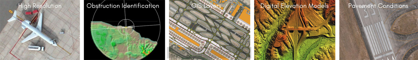
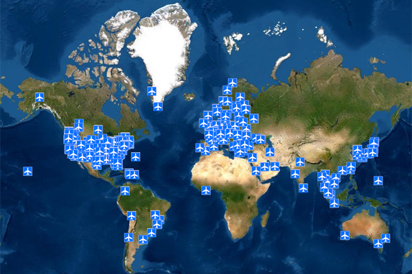
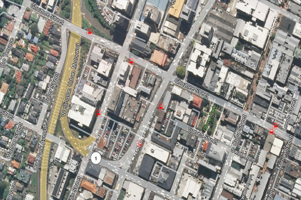
 Airport Imagery Archive
700+ Airport Orthos are currently available off the Shelf
(RTCA DO-200A and AC 20-153A Compliant)
Sub-Meter Ortho Accuracy using:
- State of the Art software
- High resolution satellite imagery
- Engineering grade GCP collection
- Post-processing expertise
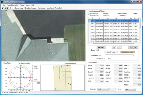 CompassAA
Verify Imagery ACCURACY and QUALITY Automatically
- Streamlined Accuracy and Quality Control
- Comprehensive Analysis Reports
- Cost-Effective Verification
- Compliance with NSSDA, ASPRS, NM AS, and MIL
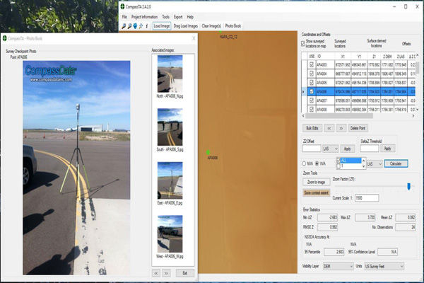 CompassTA
Automatically Tests and Verifies the ACCURACY of elevation data products
- Flexible elevation data verification
- Standards-based reporting
- Cost-effective verification
- Auto extraction of elevation
- Shared analytics
 Custom Basemaps
Accurate and Current Imagery and Basemaps Ensure Mission Success
- Rapid deployment of current basemap
- Entire countries are delivered in weeks and small areas of interest in days
- Options include:
- Road Systems
- Terrain
- Land Uses
- Point Elements
- Other Geographic Layers (Tailored to Workflow)
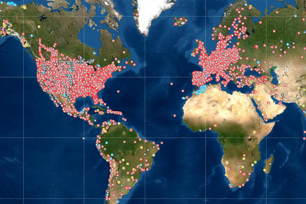 Ground Control Archive
Access the World’s Largest Commercially Available Ground Control Points Archive!
- Greater than 60,000 worldwide GCPs in archive
- Photo-ID GCPs
- LiDAR NVA Control
- Airport Photo-ID GCPs
- Remotely Sensed Ground Control Points
 Off the Shelf Imagery
Hexagon
- Completely scan your area of interest at the highest level of ACCURACY
- Collection utilizing aerial, drone, or mobile deployment methods
- Extract key elements and classification to share your data within your organization
- Deliverables meeting your specific requirements