Golf Green Mapping Software
Golf Design, Simulation and Operations
- Timely new data acquisition
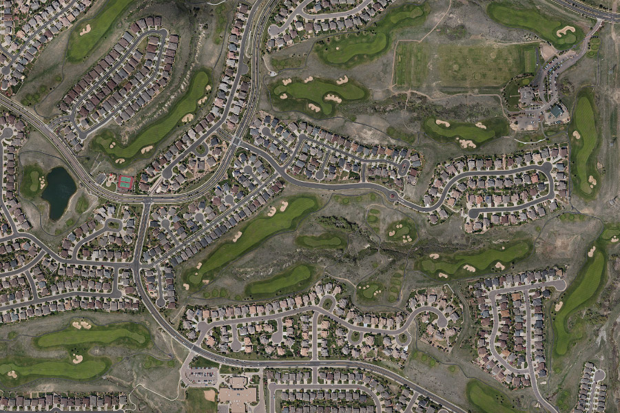
- Orthoimage of your course flow and captured by CompassData
- Processed using our professional geospatial tooling and expertise
- High resolution, spatially ACCURATE aerial imagery and LiDAR has limitless potential
Benefits of Golf Solution
- Golf course simulation that is identical to the real course
- Have ACCURATE irrigation infrastructure mapping
- Reduced maintenance costs
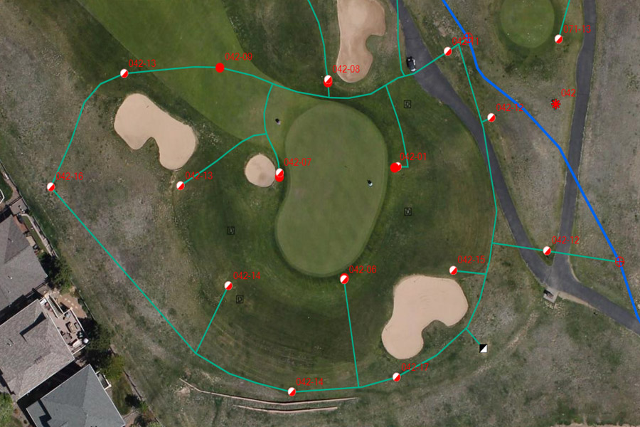
- Irrigation Lines
- Sprinkler Head Location
- Material Purchasing
- Operational Management Time
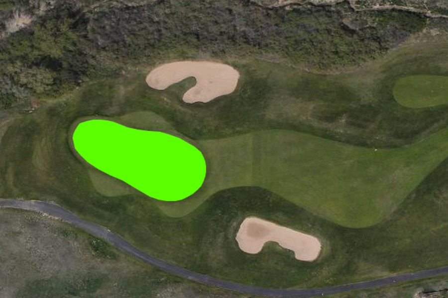
Golf Terrain Design & Simulation
- Geospatial data golf course simulator terrain solution
- Digital terrain models (DTM) for integration into golf course simulator
- Operational mapping of the course with imagery for integration in the Toro Lynx Central Control Software
- Maintenance without leaving the building
Reduced Course Maintenance
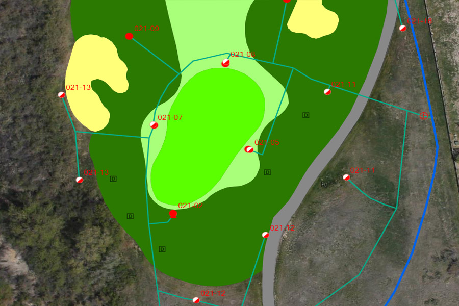
- Irrigation mapping on top of the orthoimage gives course superintendents the ability to configure all irrigation heads and water appropriately
- The associated data for each head can give psi, range, and volume statistics
Features of Golf Solution
- 10 cm x,y,z Photo-ID ground control points
- Digital terrain model (DTM) for golf simulator software
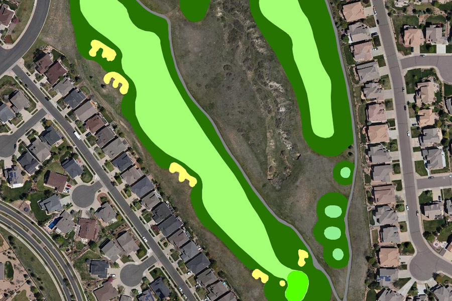
- Golf course asset, course, and irrigation mapping
- Orthoimage and irrigation features for Topo Lynx software integration
- Course features and asset data map for maintenance