Ground Control Points Archive Copy - CompassData, Inc.

Access the World’s Largest Commercially Available Ground Control Points Archive!

CompassData offers the largest commercial archive of Ground Control Points (GCPs) in the world—essential for enhancing the accuracy of satellite, aerial, drone, and LiDAR mapping projects.

CompassData offers the largest commercial archive of Ground Control Points (GCPs) in the world—essential for enhancing the accuracy of satellite, aerial, drone, and LiDAR mapping projects.

Over 80,000+ High-Accuracy Ground Control Points Available Off the Shelf

You can instantly request access to our GCP archive. Download Ground Control Points as Esri Shapefiles to load into your GIS software or as KMZ files compatible with Google Earth Pro.

Request Your Free Ground Control Point Sample Data Today


Get sample Ground Control Points (GCPs) from the CompassData archive to evaluate data accuracy for your drone, satellite, LiDAR, or aerial mapping project.

Contact us now to receive your free sample file and start improving geospatial precision!

Whether you're processing drone imagery, satellite data, aerial photographs, or LiDAR scans, using Ground Control Points (GCPs) ensures true geospatial accuracy by providing verified “Ground Truth” coordinates that align your data with real-world locations.

Utilizing Quality-0 Ground Control Points during the orthorectification process can achieve absolute positional accuracy within twice the pixel size of the imagery—enhancing mapping precision, reducing geolocation errors, and minimizing the need for time-consuming data corrections or reprocessing.

Our global Ground Control Point archive is displayed on an interactive map where you can explore individual points, view photos, station diagrams, and detailed accuracy reports. Request access to download the full archive (truncated) in Esri Shapefile or Google Earth KMZ formats to integrate directly into your GIS or mapping platform.

Accuracy Levels of Ground Control Points

All Ground Control Points (GCPs) in the CompassData archive are validated through rigorous quality assurance protocols under our ISO 9001:2015 certified Quality Management System, ensuring reliable, high-accuracy geospatial data for professional mapping applications.
Each Ground Control Point is classified by accuracy level, defined using 95% Circular Error (CE) and Linear Error (LE) standards:

  • Quality-0: Horizontal accuracy 1–5 cm, Vertical accuracy 1–5 cm
  • Quality-1: Horizontal accuracy 5–10 cm, Vertical accuracy 5–10 cm
  • Quality-2: Horizontal accuracy 10–20 cm, Vertical accuracy 10–20 cm
  • Quality-3: Horizontal accuracy 20–50 cm, Vertical accuracy 20–75 cm
  • Quality-4: Horizontal accuracy 50 cm–2.5 m, Vertical accuracy 75 cm–5 m

These defined accuracy levels help clients select the most appropriate Ground Control Points based on the precision requirements of their drone mapping, satellite calibration, LiDAR control, or orthorectification projects.

Ground Control Point Delivery & Data Format

Each Ground Control Point (GCP) from the CompassData archive is delivered with a complete, ready-to-use data package designed to integrate seamlessly into your GIS, remote sensing, or mapping workflow.

Deliverables includes:

  • Coordinate File with latitude, longitude, elevation, projected Easting and Northing values, plus detailed metadata—available in text or spreadsheet formats
  • Accuracy Report detailing positional precision and quality rating
  •  Image Chip showing the exact location of the Ground Control Point (GCP)
  • Surveyor Site Sketch with visual documentation of the GCP placement
  • High-Resolution Photos of the survey setup, including close-ups and views in all four cardinal directions
  • Geospatial Files such as Esri Shapefiles and Google Earth KML for easy visualization and integration

Support is available for standard coordinate systems and geodetic datum conversions, ensuring compatibility with your specific project requirements.

Photo-ID Ground Control Points (GCPs) for Imagery and LiDAR

Photo ID for imagery

Photo-Identifiable Ground Control Points are readily available from the CompassData archive to support the production and QA/QC of satellite imagery, aerial photos, and LiDAR datasets.

These off-the-shelf Ground Control Points are visually distinguishable in imagery, making them ideal for precise orthorectification, accuracy assessments, and geospatial validation workflows—without the need for field deployment.

LiDAR NVA Control with Photo-ID Ground Control Points

PHOTO-ID GCP FOR LIDAR

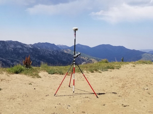
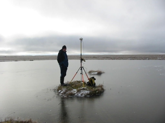
CompassData’s Ground Control Points (GCPs) support Non-Vegetated Vertical Accuracy (NVA) control for LiDAR data production and QA/QC—without the need for time-consuming field surveys.

These photo-identifiable, off-the-shelf GCPs are ideal for validating LiDAR elevation accuracy and ensuring compliance with industry standards. Access immediate, high-precision GCP data for streamlined geospatial workflows and reliable vertical accuracy assessments.

Airport Photo-ID Ground Control Points (GCPs)

Airport Photo-ID GCPS

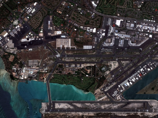
CompassData’s Ground Control Points archive includes strategically placed photo-identifiable GCP clusters near more than 1,100 airports worldwide. These airport Ground Control Points are processed using the FAA DO-200A standard, supporting both authoritative and commercial imagery production for global aerodrome mapping and analysis.

Ideal for orthoimage calibration, GIS updates, and aviation infrastructure planning, our airport GCPs ensure geospatial precision where it matters most.

Remotely Sensed Ground Control Points® (RSGCP®)

Retro Reflector

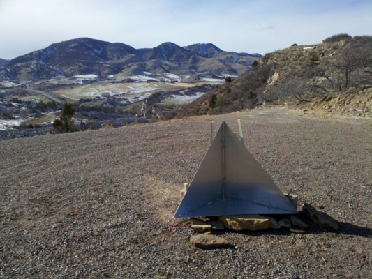
Remotely Sensed Ground Control Points® (RSGCP®) are precision photo-identifiable points derived from Synthetic Aperture Radar (SAR) and high-resolution imagery. Designed for remote mapping, these GCPs provide RS-1 Precision ≤ 1m or RS-2 Precision ≤ 3m, enabling accurate geolocation without field deployment.

RSGCPs are the ideal solution for satellite image calibration, orthorectification, and photo control in regions that are politically sensitive, inaccessible, or logistically difficult. Eliminate the need for onsite surveys while maintaining high geospatial accuracy.

Frequently Asked Questions FAQs

Download Your Free Ground Control Points (GCPs) Sample Dataset

Explore the quality and accuracy of CompassData’s trusted GCP archive—used by top mapping professionals worldwide.

Explore Our Sample Geospatial Data

Discover the accuracy, quality, and depth of our geospatial solutions. Download a free sample dataset and experience the CompassData difference.

View Sample Data